Hazard reduction burn in Deua National Park
The NSW National Parks and Wildlife Service (NPWS) is planning a hazard reduction burn in Deua National Park, west of Moruya, tomorrow 1 October, weather permitting.
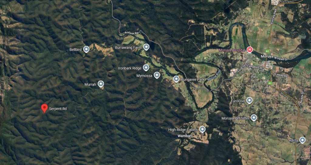
The hazard reduction burn intends to treat approximately 420-hectares of bushland in the vicinity of Serpent Road and Ash Fire Trail.
Hazard reduction burns are essential for reducing bushfire fuel loads to help protect parks, neighbours as well as the Moruya community if a bushfire occurs in the future.
Track and road closures will be in place in the vicinity of the burn including the western side of Coondella and Gallery Roads and the northern side of Wamban and Donalds Creek fire trails.
Smoke may be visible along sections of the Princes Highway so motorist are reminded to drive to conditions.
For their safety, the public should not enter closed areas while the operation is underway and adhere to all safety signage.
Tracks and roads will be re-opened when it is deemed safe to do so.
Visitors must check NPWS Alerts for up-to-date information on closures.
Planned low to moderate intensity burns also aim to improve the park’s biodiversity and provide safer access for firefighters.
If you are vulnerable to smoke, try to stay indoors, keeping doors and windows closed to reduce your exposure.
People with known health conditions can sign up to receive air quality reports, forecasts and alerts via email or SMS from the Department of Climate Change, Energy, the Environment and Water.
For health information relating to smoke from bushfires and hazard reduction burns, visit NSW Health or Asthma Australia.
More information on hazard reduction activities is available at NSW Rural Fire Service and the NSW Government’s Hazards Near Me website and app.